Sunday, November 30, 2014

IUFRO & SAF/CIF World Congress 2014

IUFRO & SAF/CIF World Congress 2014Salt Lake City, Utah, USA


IUFRO = International Union of Forest Research OrganizationSAF = Society of American ForestersCIF = Canadian Institute of Forestry


Breakfast in Bend on our way to SL

For the first time ever three international forestry organizations collaborated for the world’s largest forest professional gathering ever! A combination of over 6,000 people from around the world congregated to learn cutting edge research discoveries, network with new colleagues, and learn from peers. 

Opening Ceremony featuring Native American
from South Western tribes. 
Joining the Oregon State University Chapter of SAF in Corvallis, OR we made the long drive to Salt Lake City, Utah in one day.  There were 12 of us embarking on this trip with the support of OSU College of Forestry and Oregon SAF Chapter.  Fundraising and organization mostly by our Chair, Sam Delano we were down for the adventure.  Kudos to his leadership!

The week was packed with lectures, networking, and learning.  I attended lectures each day with the intention of taking notes of the highlights.  Some talks had multiple speakers during the session and all had time for questions from the audience.  It was fascinating hearing some professional takes on critical topics. 

The topics that I enjoyed most were the social science of forestry and climate changes.  I was particularly inspired to better understand how foresters can and are learning to be more effective communicators and public representatives.  Forestry is more involved with the public’s needs than ever before. Forestry cannot survive without further involvement and education of important forest practices and processes.  There were themes focused on the gender balance in the industry but also the importance forest management can impact communities.  The Sierra Nevada Adaptive Management Project works as a neutral party with the support of research and community involvement.  Or in Nepal wood is valued for fuel and without community participation the forests were depreciating at rapid rates. 

I connected with other students and deans for universities across the world.  Graduate students were the most common for most of the conference.  They were given the opportunity to present a poster on their topic of study. Hearing from Dean John Innes at University of British Columbia   was interesting to better understand the disconnection between the industry professionals and academia.  Goals and resources differ at each institution.  A challenge that universities face to prepare students is to keep up to date with technology. Like many disciplines it is evolving too fast for courses to stay entirely relevant.  It challenges universities to produce accredited programs when standards vary so drastically internationally.  He agreed that depth was challenging to balance with breadth of forestry education. 

Climate change was a theme throughout the event.  David Cohnen was a speaker that stuck with me. He reminded us that our population is growing at incredible rate and that soon we are going to reach 7.5 billion people! Commodity prices are increasing including non-renewable resources.  The challenge of our generation will be to provide the innovation and resources to be productive enough to sustain a growing population with limited resources.  He pushed idea of Reduce, Reuse, & Recycle as a huge player in the future. The connection with our forests is that the urbanization and construction leads to deforestation when the wood is bought from places with less regulations and sustainable forestry. Our forests are becoming a more recognizes source of multiple resources and functions.  The public is demanding new uses of the forests and the world is still learning how to meet that demand in a way that is sustainable and capable of being multi-functional.

The event was highlighted with social events that gave opportunities for delegates to meet others from around the world.  The food was fantastic and the open bar was appreciated.  Live music adorned the first social event.  The more casual atmosphere definitely made opportunities for more laid back conversations.

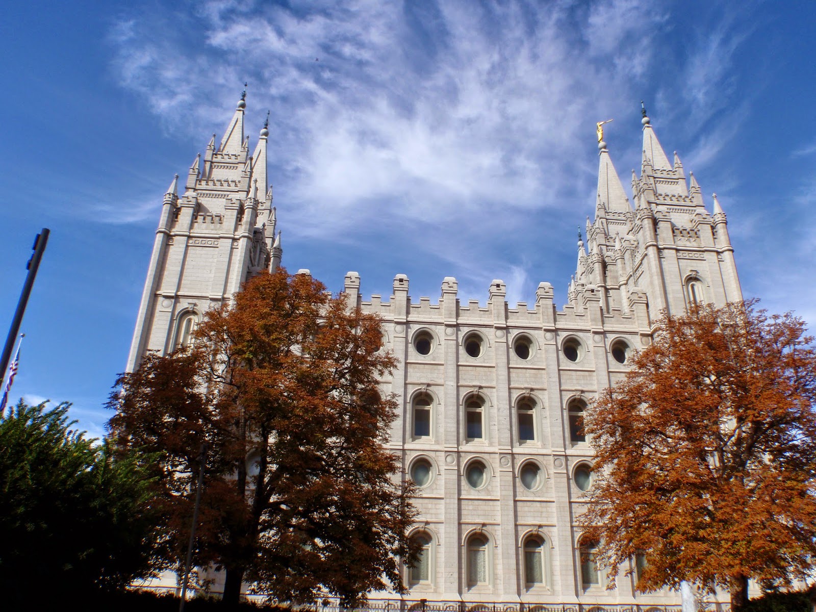
On Wednesday of the Conference I attended a Field Excursion.  Hopping on a tour bus we rode out to the mountains.  Salt Lake is beautiful in the fall time. The birch trees were just changing colors and contrasted beautifully with the firs.  The topic of discussion on the trip was urban forestry. We visited the local National forest that provides water to the city. On the bus I met several people from Canada and a few from Vancouver Island itself.  The world is so very small.  I walked with several people from Brazil, Ghana, Switzerland, and more.  The perspectives of this international crowd were fascinating and made the trip worthwhile. 

The last few days of the conference the Oregon State students and staff at the event helped the representing booth.  It was fascinating to realize the international reputation our College of Forestry has.  The unique programs and friendly staff are something to look towards. 


Attending IUFRO World Congress was an experience well anticipated and I am incredibly happy that I was fortunate enough to attend. The networking I was able to do was impressive.  It helps me see the opportunities available in this industry is astounding and hopeful that I will figure out where I can fit in. 


OSU staff at the Booth


New friends from Nepal, Sweden, and Malasia

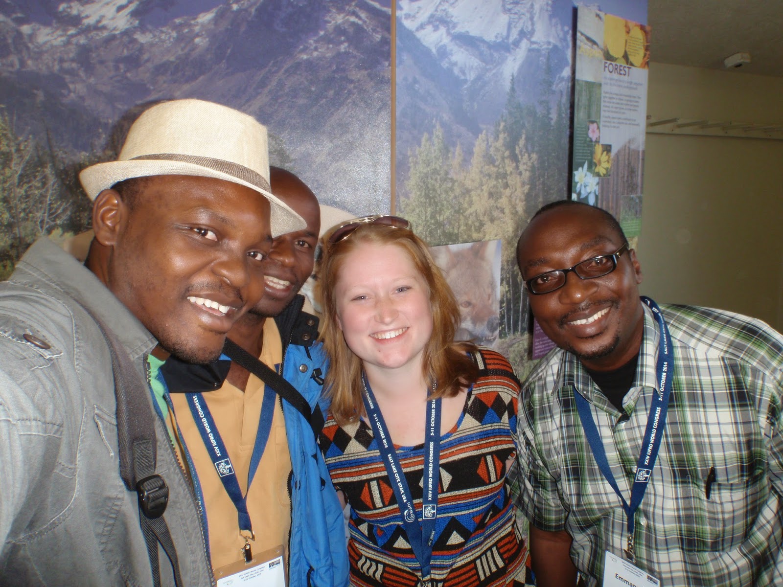
Men from Ghana and Kenya


SAF Lunch break in SLC

View from my plane ride to Portland

Saturday, November 22, 2014

Landslides Ahead!


This landslide overflowed onto a mainline.
It measured about 3/4 hectare or 3 acres.
Yreka Main.
Culvert overflow.
Teeta 500.
Okay so one should know a little bit about what causes landslides. WATER! Well look at that when it rains a whole bunch the soil can become saturated and liquefies and gravity moves it downward!  It is particularly common in areas with steeper slopes, thicker soils, and exposed soil.  While logging can exacerbate landslide frequency proper forest management and road building can help lessen the impacts.   Over the last 100 years logging practices have changed a whole lot.  Heck in the last 20 years they have changed drastically!  So when the land is exposed and saturated the likelihood of landslide occurrences increases.  As land managers we can do our best to mitigate impacts.


Yreka Main road failure. 1of 3 in close proximity.
At Western we abide by a guide of TRMS or Terrain Resource Management Systems.  This guide differentiates high-risk terrain areas and requires professionals to follow a detailed list of measures to alleviate risk.  A geotechnical professional is hired to walk all of the blocks highlighted as potential risk.  They look at the rock formations, soil types, old slides, new/old road placements, steep terrain, streams, and everything in between. The goal is to minimize risk for debris flow especially that would impact fish bearing streams and habitats with high values environmentally and economically.  A combination of reports and thorough interpretations of the landscapes engineers and foresters develop plans to reduce risk and hazards for equipment operations and land movements. 
Matt & I on heli
Randy & I on heli.


Landslides happen but management is key.  For instance, this last October the North Island experienced a heavy rain event.  In fact it was 223 mm or almost 9 inches of rain in 24 hours!  As you can imagine a few landslides occurred. When 100mm of rain in 24 hours happens operations are shut down. The areas that this occurred in experienced enough slides that delayed logging and safe access to many parts of Jeune Landing. 

My place at the bottom of the slides to survey.
Really muddy!


The following week after the rainfall shutdown was lifted I accompanied the area engineer; Chris, forester reporting landslides; Matt, and operations foreman; Randy in an Astar Helicopter to check things out.  Our purpose was to record and summarize the events and damages obstructing equipment and block access.  For two hours we flew taking pictures and points of slide and road damage.  The more we knew the more efficiently we could delegate clean up tasks to the crews.  We recorded well over 50 incidents that either required clean up attention or was greater than ¼ hectare to be reported to the ministry.
The slide went all the way to the ocean!
Yreka Main.

Matt the modern day forester. Heli + Ipad. nbd
Jeune Landing.

Rock truck and hoe before much work was done.
Teeta 500.
Later on I was on site for one such clean up.  A road fill failed a corned on Teeta 500.  The road was likely originally built in the 1930s.  It is used as a mainline to connect the East to the West coasts of the island.  Hauling was occurring prior to the storm and was not safe to afterwards.  An outside engineer used a design to plan out a new fill to best suit the road.  The fill was situated on an 80% slope and required significant rocks to replace and hold up. We did not know how far we’d have to dig to find a bench to lay a new road or if we’d be luck and find bedrock.  The new fill was built up on huge pieces of rock blast out of a nearby bluff. Many truck loads of rock and fill was removed to expose the bench and set the proper road prism.  The project took almost 4 days to complete.  It closed the mainline for at least a week. There was a rock truck, excavator, and rock drill present to assist in the clean up project. 

Survey equipment and Rock drill preping to blast!
Teeta 500.
In addition to assisting with the road repair, I recorded the significant landslides to present to the ministry.  It became my job to measure the areas using pictures and Google Earth.  I had to identify the cause and effect of each incident. The tracking of these occasions are documented for further analysis for a more complete understanding of the geology and landscape reactions to landslides and debris flows.  They are associated with particular storms and can prove how severe the storm was and where it was focused.   


Improvisation at its finest!
The rock drill's boom was bent and the hoe's bucket straightened it out.

Giving the heated metal leverage.
Good thing a welder was around! Ha.


Saturday, November 8, 2014

Dryland Sort


 Dryland Sort

The Lower Dryland Sort at Port McNeill is a major funnel of timber on the North Vancouver Island.  Nearly all of the wood on the east side of the claim is brought to this sort.  The export logs in the claim all come to this sort to be stick scaled.  Many of the logs are boomed down to add to other export inventories.  The Lower Dryland is one of the busiest sorts of the North Island because of the amount of wood that passes through the systems. 


Weigh Scale
A great portion of the logs are weigh scaled. This means that the sorts of logs on the truck are proven to generally be relatively similar and through weight measurements can take a decent estimate of the volume on the truck.  The truck drives on to the scale located at the upper sort and takes the weight.  It then trucks the load down to the lower sort to be unloaded and banded together.  A certain portion of the weigh scale loads must be sampled in order to best estimate the total volumes on each truck.  That sample is then scaled by hand on the deck.  

Stick Scale
When the truck comes in with a wider assortment of logs the load must be stick scaled.  This means the load is laid out for the scalers and graders to calculate volumes, quality, and sort.  All loads with cedar and old growth are stick scaled to catch the variability in the wood.  Scalers and graders check the lengths and diameters to identify possible sorts.  They then look at the size of knots, any rot, or damage to the wood that decrease the value of the log.  With spray paint they may mark lengths that it should be cut by the buckers on deck.  The sort is also marked on the log ends to be further sorted into boom sticks. 

Hooking up logs to pull the boom sticks tighter together
Boom Makers
When the logs are finally scaled, graded and sorted they are banded together with the Bandit.  The two wire cables are locked and the logs are then dumped into the water.  The boom makers in their bumper-car-like boats maneuver the bundles into the allotted ‘sticks.’  The boom sticks are comprised of four bundles across and as many as eight in lengths. It depends on the frequency of the particular sort.  Each boom stick is then attached to all the other sticks ready to be attached. When a full boom is ready a tug boat arrives to latch on and push the logs south.  As many as two booms may be made per week at Port McNeill dryland sort.
It's like playing bumper cars in the water
The boom stick maker.  The logs that surround each boom stick bundle.
Connection to Mills Demands
The dryland sort is intricately connected to the demands of the mills. The mills’ demands react to the market way more quickly that the persons in the woods can react.  It is important for the dryland sort foremen and quality control persons to be tightly coordinating with the bucking prescriptions produced.
The barge with a wench to tighten bundles


Sunday, September 28, 2014

Retired Foresters Tour North Island

Last week a group of retired foresters visited the North Vancouver Island to see different aspects of BC forestry.   The group consisted of men who combined have over 400 years of experience in the forest industry and sciences.  WFP was kind enough to send me on one of their tour days in the Port McNeill area.  The 11 retirees and the working professionals planned an introduction and explanation of how forestry in the North Island is different than other areas in BC. Western was the main host because they are the main timber company here or Tree Farm grantee. 
 
Stop #1: Dryland Sorts
We visited the lower and upper dryland sorts.  The lower sort is the main sort where logs are dropped into the water after being graded and scaled.  Jerry the yard foreman discussed how the majority of North Island’s timber moves through the lower dryland sort.  There are 6 decks for graders and scalers to work safely around the machines.  The Wagner or Stacker can pick up to 40 tons or an entire log bundle and dump it into the water. 

At the upper dryland sort export logs are stored.  Export logs are all trucked or transported to this yard to collect enough to make a boom. They are then pulled to the south Island to be placed on a container ship.  Poles are also stored here, laid out for buyers to grade and bid.    There is also a weigh scale where more uniform loads can be weighed instead all scaled by hand. 


Stop #2: Orca Sand & Gravel

The Orca Gravel pit has incredible scale.  They have a special use permit on Western’s Crown granted lands.  They are allowed to produce 128 million tons of rock material.  It opened in 2007, seriously bad timing.  Annually they export 4-6 million tons to California, usually San Francisco.  They mine, they sort, they clean, and they export.  This market is heavily dependent on the economic stability.  Almost once a week a barge shows up to ship 40 tons of gravel to San Francisco.  A conveyor belt runs under the highway, about 500m to the ocean, to the transport barge. 

The way the rocks are mined is with these huge tractor scrapers that drive along the bottom of the pit assisted with another to push along the floor until full.  Each scraper can collect up to 4 tons of material. They then bring it to the plant it self to sort and clean.  The piles are on top of sieves that can move the material with a shaking motion along conveyor belt to export.


Waste Management Site off Misty Main

Stop #3: Waste and Stumpage Program
Western recently partnered with a local contractor who utilizes the left over waste from clear-cut harvests.  We visited the first block the partnership began with.  WFP must pay for the left over wood or stumpage to the Crown.  By partnering with this contractor multiple parties benefit while additional use is made of the waste without additional cost. The wood is used for Sea Soil.  It is chipped up and mixed in with fish waste products to create a nutrient rich soil for home gardens.  You may even be able to find it in your local Home Depot. The logs are grinded in my front ‘yard’. It’s loud… 


Stop #4: Quatren, First Nation’s Partnership
Gord, Ralph, Dave, & Ray speaking about Quatren
Next we visited an active harvest site to talk with First Nation, Quatsino leader Ralph and other Western employees active in the partnership discussions. Quatren is a partnership with the Quatsino Tribe and Western to work together so that both parties benefit from the forest resources.  Quatren is a star child within Western to set an example to other branches to coexist in order for both parties to benefit. Together they share profits from working on Crown land 50-50. 

In British Columbia the First Nation Tribes have great influence on industry.  It is a touchy subject that brings out many opinions and challenges for communities and industries.  Companies must recognize that they cannot survive long term without support of the communities they work in yet; it is difficult to please all parties. 


Stop #5: Seven Hills Golf Course; Community Forests & Public Advisory Council
Seven Hill Golf Course is surrounded by prime forests but with acreage, sorry hectares of grass to play golf.  It is located almost equally between three communities for best access.  Again this area was located on Western’s Tree Farm License but given up to benefit the community with a special use permit.  Now one can play golf and even aim at the bears that wander on to the course.  We had yummy salmon burgers at the cafĂ© while we heard two people talk.

The Community Forest is a partnership between Port McNeill, Port Hardy, and Port Alice; three communities in the North Island.  A community forest is a special kind of land tenure that lasts forever granted by the crown.  Out of the 57 in BC, their CF is 50th is size yet is also the most profitable. This has to do with the dedication of professionals.  It doesn’t hurt that in Port McNeill alone there are 130 Register Professional Foresters out of the 4,000 residences. The towns act as shareholders and delegate a council appointed board of qualified forest professionals to maximize profits.  All proceeds go equally directly into the communities.  In the last four years that they have been in operation the communities have received funding that benefits sewer, power, hockey rinks, and curling clubs.  The CF helps fund the nuts and bolts of the communities. 

The Public Advisory Council is a group of professional representing public committees between Port McNeill and Port Hardy.  I’ve had the pleasure to attend one such meeting so far.  Anne Mary presented her perspective as an active member in the community on the importance of forestry activism and community involvement.  Once again the urgency was repeated among those present the dire need for more training and interest in the forest industry to see it to continue successfully. 

Stop #6: SCHIRP Research Project
Annette, our informative SHRIP expert
The SCHIRP or Salal Cedar Hemlock Integrated Research Project began in 1988 and has been a significant source of forest research in the North Island.  This integrated project was to measure and monitor the interaction between forests and brush management. Salal in particular can grow particularly thick yet can grow successfully with western redcedar.  This area has been a place of research for countless masters and PHD students that examined the complicated relationship with these ecosystems.  They have seen some incredible results.  The brief tour was a small introduction to the complexity of the many plots.  However regular fertilization and high densities have seen great success in brush management and tree volumes. 


Conclusion
Participating in the tour allowed me to meet, talk with, and listen to some of the most experience foresters in British Columbia.  I hope to see some of them again because I know they can teach all foresters a thing or two.  Hearing them talk and argue about current forest issues shows their dedication and love of forests.  It inspires me to motivate others to consider working in the woods. 


Thursday, September 25, 2014

Learning the Layout


Investigating an old logging road
Practicing laying out a block is a bit different than laying it out for work.  Firstly, it is with a very experienced forester versus beloved classmates.  Secondly the timber is actually going to be harvested instead of being a hypothetical area.  It is not over a four hour lab period but several 10 hour days.  While school is comfortable, learning in a professional setting drastically enhances that education.  
Good sized second growth timber

While I have been doing bits and pieces of laying out a block over the course of the last month and a half this time I am assisting in the entirety.  Working with Greg a well-experienced forest engineer he is teaching me how he sees the forest.

Getting to know the Block
Primarily we must understand the contents of the block in order to assign potential systems of harvesting and areas that could be hazardous.  We have to identify streams, timber volumes, rock hazards, sensitive areas, culturally modified artifacts, protected animal habitat, and a whole more.  We must gain an understanding of the landscape, terrain, and features to best fit a harvesting system.  This is called reconnaissance or reckie in Canada or recon in Oregon. 

Harvest System Options
Found a swamp in the middle of a block
While identifying the harvest systems available one must consider the equipment the particular company or contractors have on hand.  One is able to choose from ground based, cable systems, or heli-logging.  The cost increases in value in that order.  Port McNeill offers hoe chucking or shovel logging for ground based systems and are only used on lower slopes.  Cable systems in PM include grapple yarding and snorkel booms.  Grapple Yarders are most common.  Helicopter logging is incredibly expensive and are only consider for high value, steep sloped timbers.  At this point western redcedar is the wood of highest value in general. 
Gathering points with GPS at a Falling Corner

Laying Boundary
Once an area is more of less understood boundary tags are put in the block and marked using a GPS to draw a map.  Boundary must include riparian management areas (RMAs) and special management zones in order to comply with best forest practices identified by both the Crown and WFP.

Surveying the Roads
Once the boundary is set, roads will be put in with surveying methods.  The roads are placed in to best access the timber to load on to trucks. Landings are built on the roads to process the logs and load the trucks.  We as planning engineers use lasers to measure distances, a clinometer to get slopes, a GPS to map and a notebook to record.  Marking tape shows road builders where the road center line should be placed. 

Surveying a road with a laser
Finalizing Harvesting Instructions
The combined information gathered through laying out a block is then combined into a pack of harvest instructions that will be added to an entire package.  Foresters for planting and extra instructions regarding harvest and post-harvest treatments will add to this package.  Geotechnical engineers, biologists, anthropologists are all consultants who may be contacted for further information and professional advice.  The combined information will then be submitted to the Ministry of Forests to be approved.

This is a simplified version but I am still learning and want to teach the audience of this blog what I am doing in the woods.