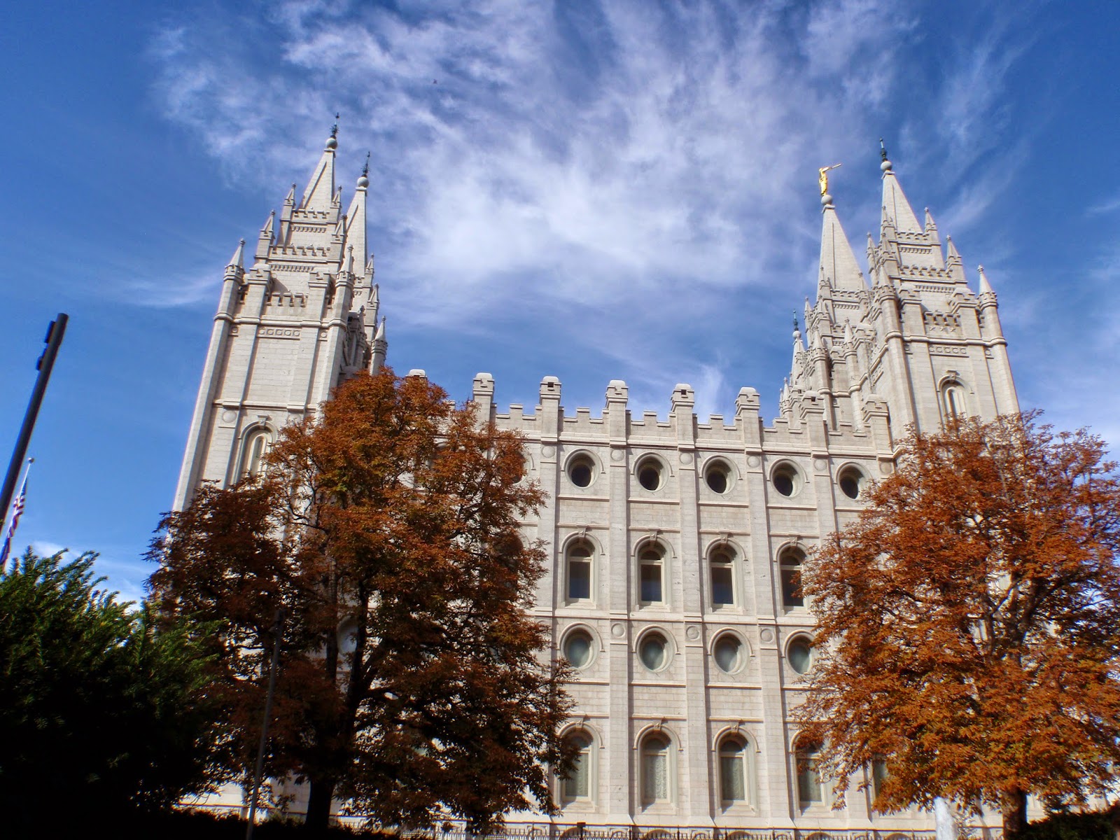
Sunday, August 16, 2015

Intern Profile


First solo backpacking overnight in
Crater Lake National Park
My work experiences have been varied but centered around the intention to broaden my understanding and technical skills needed in the forestry field.  I will be completing two degrees in Forest Engineering and International Studies in June 2016 from Oregon State University.

For the Summer of 2015, I am an intern with the Ashland Forest Resiliency Project (AFR) in Southwestern Oregon.  It is a very unique experience because I am working with four partners throughout the summer on various aspects of the management that goes into working with a collaborative team.  The team includes the US Forest Service, The Nature Conservancy, Lomakatsi (NGO), and the City of Ashland. 

I split my time between the partners.  It is a combination of fieldwork, technical writing, and public or private meetings. The opportunity to work with the AFR partners broadens my understanding of active forest management interconnected with community participation.  The urban intersection with the forest and the community’s stake in the management process is unique and critical for success.  Work in this setting requires a high level of communication with multiple people. With minimal oversight to deciding my daily activities and no one direct responsibility maintaining reachable goals and clear intentions is key.  

Working in the woods
Previous work experience with Western Forest Products (WFP) in British Columbia gave me insight in the private industry managing on public lands.  It was much more traditional West Coast management with minimal complexities compared to my work at AFR.  The experience with WFP was focused more towards operations and harvesting feasibility.  It was applied engineering while I worked with professionals.  AFR is  applied silviculture and the integration of the social complexities within the management plans on federal lands.  Both of these experiences are valuable to continuing my understanding of how forest management is applied differently.


Professionally I aim to work towards managerial positions by that landscape, people, or resources.  I appreciate a position that gives me the hole picture.  I am more likely to seek positions in the private forest industry but I am open to any possibility.  I want responsibility and respect for what I know and can learn.  I am interested in working abroad for a few years in the forestry sector.  Eventually I will pursue an MBA or some way to further my education and qualifications. Personally I want the flexibility to travel and live in different places for the next ten years.  

I'm not sure where my skills can be most useful and enhanced but I have the passion for the applied science, engineering, and social needs surrounding natural resource management. 

Thursday, August 13, 2015

Wildland Fire Leadership Council Visits Ashland

Wildland Fire Leadership Council at the Ashland Forest Resilient Project
July 28th – 29th, 2015
Ashland, Oregon
Meeting purpose
The Wildland Fire Leadership Council came to Ashland, Oregon on July 28-29th, 2015.  The meeting aimed to further understand how the leadership team can build around the goals of the Wildland Fire Cohesive strategy.  The gathering included a field tour of the Ashland Forest Resiliency Project (AFR) and deliberations regarding the future role WFLC has in national landscape management.
The gathering was full of important and influential people on the Wildland fire management throughout the country.  Representatives of public agencies and private organizations came from across the country for this meeting including; US Forest Service, Department of Interior, Fisheries and Wildlife, The Nature Conservancy, Fire Adapted Communities, Natural Resource Conservation Service, Bureau of Land Management, National Association of Counties, Association of Governors, City of Ashland and many more.   People came from all backgrounds with the purpose to address the ongoing wildland fire management.  Most notable was the presence of USDA Secretary Robert Bonnie and US Forest Service Chief Tom Tidwell. 

Field Trip
Tuesday’s field trip demonstrated the approach of the AFR project as a successful and forward thinking example of implementing the Cohesive Strategy within an ecosystems services framework.  The partners aimed to demonstrate to visitors the successes and challenges of working with a collaborative approach for forest restoration and wildfire hazard reduction. 
Ashland Mayor John Stromberg
Context at Reeder Reservoir
We began the tour at the Ashland City reservoir.  Overlooking the city’s water source we got a briefing on the history of collaboration and forest management in Ashland. Partners from the US Forest Service, Nature Conservancy, and the Mayor of Ashland set the stage for some context of how a highly engaged community and interfaced with dry forests became more accepting of active forest management for wildland fire, ecosystem restoration, and water availability.
Ranger Donna Mickley, USFS
Background consisted of how the city acquired land; historical timber industry; effects from major flood events; and the community engagement offered the obstacles community leaders had to overcome. 
We observed the reservoir storing 6 weeks worth of water for the City.  This backdrop set the stage that the community directly feels the water constraints.  The city’s effort expressed a voluntary request by its citizens to contribute to the water conservation by decreasing their personal use.  Within a year a 30% decrease in water consumption was observed.   In addition, the city also initiated a small fee added on to the city’s residents’ water bill to go directly towards ongoing watershed management.
            White Rabbit Trailhead
Forest Division Chief
Chris Chambers
At this stop we spit into a three group rotation in order to be exposed to the many caveats of being a part of a collaborative that manages natural resources with a high degree of community input and agency oversight.
Robert Bonnie
USDA Secretary
We observed an example of successful prescribed fire.  The discussion focused on the challenges with using fire as a tool in the Pacific Northwest.  The challenges are primarily due to maintaining air quality according the National Air Quality regulations.  When smoke is created, it tends to sit in the valleys where communities often reside.  Health concerns are high priority and the constraints make it impossible to effectively use fire.  The Ashland Watershed had three days to burn in 2014 with nearly 2,000 acres of burn piles currently ready for flames.  A Florida representative exclaimed they had over 200 days to burn.  Prescribed fires are used to reduce fuel build up and to simulate what resilient ecosystems experience when a wildfire runs through.
Marko Bey
Exec Director at Lomakatsi
Then with different representatives from the US Forest Service and NGO-organization Lomakatsi Restoration Group funding, grants, and agency implementation was discussed at length on the newness of integrating collaborative management to a landscape scale. The theme resounded that using a Stewardship Agreement between the partners and the US Forest changed the dynamics of collaboration.  The table was evened so that those working with the forest service could be treated equally as truer partners. 
Don Boucher,
Stewardship Coordinator, USFS
Finally, the message of that intense diversity and land management objectives was truly a feat to conquer.  The incredible complexity and diversity found within a small area of the watershed is astounding and the partners have achieved a high level of success to combine the staggering objectives.  While the objectives prioritize ecosystem resiliency, wildland fire risk reduction, and water quality, the nitty gritty details are not always addressed.  For instance at the project level forest health varies, volumes are not commercially viable, social values, and sufficient supporting infrastructure. 
           
Private Property and Youth Crew
“All hands, All lands” approach has extended the fuels and ecosystem treatments from solely federal lands to private landowners throughout the watershed.  The NRCS has been instrumental in funding projects for landowners in strategic areas surrounding Ashland.  The property we visited was an exemplary example of progressive fuels management in a tense environment.  For over twenty years, the significant member of the community landowner entrusted a forester, Marty Main, with fuels management near town.  Amazingly the juxtaposition of federal and private land looks remarkably similar on both sides of the fence thanks to the hard work of AFR and the landowner.  Currently private lands surrounding Ashland are getting grants from the NRCS to fund fuels treatments on the outskirts and interspersed with the watershed. 
Marko Bey and crew leads
   Midway through lunch, 20 young people descended from the adjacent slopes. They were apart of the Lomakatsi Youth Crew.  For one month in the summer high school juniors and seniors were hired to a work and education experience in a professional setting.  They work for most of the morning and then are joined by experienced professionals for a focused lesson around forest and natural resource restoration.  This introduction to working in natural resource management is hugely influential on the people by demonstrating the complexity and science of managing natural resources.  Lomakatsi Restoration Project is a setting a high bar for training an effective new workforce. 
Lomakatsi Youth Crew
            Community Input
Upon returning to the downtown Ashland, discussions transitioned to presentations about community involvement.  Local researchers with Southern Oregon University presented social science data that supported the significant contribution outreach provided to the success of the project.  This was demonstrated through the public survey results collected over a short period.  
   The Chamber of Commerce spoke about increasing access to tourists and community members through a collaborative effort to create a map with educational material and local trails.  
   The Watershed Art Group expressed their appreciation for watershed ecosystem services through local art projects to be sponsored and displayed on highly used trails.  A beautiful sculpture of a fisher was created by their efforts.  
   Fire Chief John Karns discussed the efforts behind the Fire Adapted Communities Program to prepare and educate homeowners to maintain safe spaces in their neighborhoods.  
  And finally Jon O’Connor from Oregon Department of Forestry and George McKinley from SOFRC, rounded it up with a summary of the larger landscape plans with the Rouge Valley Cohesive Implementation Strategy and the Southern Oregon Forest Restoration Collaborative. 

Jessica Kessinger, USFS Chief Tom Tidwell,
USDA Secretary Robert Bonnie, &
Ashland Fire Adapted Communities Coordinator Allison Lerch
Overall the WFLC was extremely impressed with the organization and presentation of the successes seen in the AFR project.  It was a long day but very successful and effective way to demonstrate the scope of the AFR project. 

My Role
It was my job to assist the City of Ashland and the partners put on the tour.  For several days leading up to the gathering, we made signs, finalized schedules, attendees, food, transportation, and the many last minute details. Chris Chambers, City of Ashland – Chief of Forestry Division, was instrumental in the entire process of making the tour going smoothly.  Allison Lerch, City of Ashland – Fire Adaptive Communities Coordinator- and myself were a part of his team to manage time and deal with the constant logistics shift. 

WFLC /AFR Perspectives & Highlights
The next day the WFLC attendees congregated to discuss lessons learned from AFR and the possible opportunities to apply the process further nationally.
To share their perspectives a panel of AFR partner representatives discussed key challenges and ways to improve the collaborative process.  The following summarizes the comments:
Mount Ashland - No snow year, 2015
  • Continuity and consistency of partner representation particularly from USFS (Don Boucher, Stewardship Coordinator)
    • Stewardship Agreement needs staff and capacity
    • Reward USFS for longevity and continuity
  • Maintaining capacity to coordinate technical and administration support
    • Internal and external training on board with Wildland fire strategies
  • Smoke management limits days to burn
    • Rebrand public perception of smoke
    • o   Shared endorsement and acceptance of risk
    • o   Widen burn windows
  • Community ownership and outreach
    • Get community buy in
    • Better integrative planning and response within communities
    • o   Increased public information and outreach
    • Emergency awareness and preparedness
  • Relationships
    • Created by transparency and trust
    • o   Stewardship Agreements shares the work and levels partner input
Out of the information was discussed and presented from the AFR perspective many questions were left for deliberation.
  • What are the causes for collaboratives to be successful?
  • How can collaboration be streamlined nationally?
  • How can we build trust while implementing the first NEPA?
WFLC members shared their own reflections and concerns highlighted during the field tour and further discussions.
  • Transformation of the vision at different levels
  • Social science involvement
  • Stewardship
Overall, participating in this opportunity was interesting to view the AFR Project with a national lens.  The challenges Southern Oregon faces are similar and different to communities around the country.  Through additional national support and collaboration they can model a methodology to ensuring safer communities and more resilient ecosystems. 

Wednesday, July 29, 2015

Intro to Wildland Fire Leadership Council


Wildland Fire Leadership Council (WFLC) was formed in 2002 in order to “provide an intergovernmental committee to support the implementation and coordination of Federal Fire Management Policy,” (Forests and Rangelands).  Created by the Secretaries of Agriculture and the Interior the council meets regularly to apply and coordinate the Federal Wildland Fire Management Policy. 

The WFLC consists of agency and governmental representation including Federal, state, tribal, county, and municipal officials.  Their oversight provides oversight to coordinate policy implementation, accountability, and effective implementation for success of the long-term strategies.  The National Cohesive Wildland Fire Management Strategy brings together stakeholders throughout the country to apply current science to meet the main objectives:
  1.  Resilient Landscapes
  2.  Fire Adapted Communities
  3.  Safe and Effective Wildfire Response
The council is broken into regions to maintain a variety of representation at different levels. Recent public and governmental support has highlighted the importance of making progress on implementing effective strategies.  The National Strategy focuses on these broad challenges:

1.              Vegetation and fuels management;
2.              Protecting homes, communities, and other values at risk;
3.              Managing human-caused ignitions; and
4.              Effectively and efficiently responding to wildfire.

More details can be seen in this brochure.

Management options are nicely summarized in the following Table.  

The management options are specific ways to gain momentum towards the national goals. The extensive landscape encompasses so much diversity though the potential risk for damage is a large majority of it.    


The powerful team of representatives tasked with the opportunity to implement the Wildland Fire Cohesive Strategy. The importance of actively managing for wildfires at a large landscape scale is critical to the health and resilience of American forests. Through regular meetings, field tours, and organizational and agency contributions private and public lands can see more effective ways to collaborate towards healthier forests and communities.


Works Cited
Wildland Fire. Forests and Rangelands. 8 July 2015. Retrieved on 27 July 2015 from http://www.forestsandrangelands.gov/leadership/

Friday, June 19, 2015

All Hands, All Lands: Southern Oregon Forest Restoration Collaborative


The Southern Oregon Forest Restoration Collaborative (SOFRC) is a regional group combining agencies and stakeholders at the same table to institute a landscape assessment and management plan.  SOFRC includes members from the United State Forest Service (USFS), The Nature Conservancy, Bureau of Land Management (BLM), Oregon State University Extension (OSU Ex), Lomakatsi, small woodland owners, and community members.  It first began meeting in 2005 and since 2010 is a 501c3 recognized non-profit organization. The purpose is to incorporate a landscape scale management effort that incorporates the social, economic, and environmental concerns of Rogue River Siskiyou National Forest in Jackson and Josephine Counties.  The intention is to include both federal and private lands included in the Rogue River Basin.  SOFRC prides itself in taking an “All hands, all lands” approach to implementing a landscape management strategy (Myer, 2013).  
            Significant goals for SOFRC are to increase the forest and resource resiliency to climate change in the Rogue Basin.  This includes addressing the change in frequency and severity of wildfires, decreased snowpack, and biogeographic shift in species range.  A challenge for managers is to apply equal weight to the economic, social, and environmental goals while managing the landscape.  SOFRC is meant to play a significant role that incorporates a multi-party collaborative team to best integrate a forest restoration approach to the varied ecosystem services.  It is limited to meeting the USFS objectives with alternative recommendations.  Broadly the goals focus on fire management, water resiliency, and an economic rationale.  Then in turn should support clean water, abundant wildlife, and local economies in order to restore the role of fire in healthy forests that are more adaptable to disturbances (Myer, 2013). 


            The Rogue River Basin encompasses an incredible amount of ecosystem diversity, varied physical states, and community densities. From the headwaters of Crater Lake over 300,000 people live within a highly economically distressed region.  Since the 1990s the population composition has increased their retirement communities, increased unemployment, and decreased resource management positions.  The forest itself is widely spread as even-age dry coniferous made up of dense and overcrowded stands.  The conditions create competitive stresses that expose trees to infestation of pathogens, insects, and diseases.  Wildfires have seen a huge spike in intensity and size across the landscape causing increased mortality at unnatural rates.  Furthermore, climate change is demonstrated through decreased snowpack and biogeographic species range changes occurring throughout the area (Myer, 2013).  The SOFRC is challenged to meet the needs of both the struggling communities and ecological changes faced in the Southwest Oregon region.  
            On June 18, 2015, SOFRC personnel from the variety of interest groups and professionals met to discuss recent updates and learn about the current state of the regional fire risk analysis.  Oregon Department of Forestry presence was noted and willingness to contribute to strategies and resources with regards to the Cohesive Wildfire Strategy.  Reminders of the anticipated goal of proclaiming Fire Adapted Communities (FAC) in southwestern Oregon are to be applied locally with a more integrated approach to the utilization of resources.  In addition, that FAC issues are not unique and that throughout the country communities collaborate about techniques through shared project results and successful strategies.  It is most useful to communities that are often underserved. 
Through the hard work of dozens of people, SOFRC is making some headway on important resource analysis in the Rogue River Basin.  Led by The Nature Conservancy and team an extensive examination of the Basin is being analyzed in order to identify key areas that would most benefit from treatment for fire management.  The analysis is based on identified values compiled through surveys of community members in order to most strategically identify these priority areas.  Through wildfire risk assessment via LANDFIRE, Relative Importance Consensus, and the National Cohesive Wild Land Fire Management Strategy a more informed approach can be applied to treat the landscape.  In its whole the analysis will summarize the total area and volume requiring treatment over a defined time scale to achieve optimal results.  
In summary, SOFRC is best described as a landscape management planning team instrumental in the outcomes of federal lands in Southwestern Oregon.  The all hands, all lands approach is vital to its success to benefit the social, environmental, and economic objectives.


Works Cited

Myer, G.. (December 15, 2013).  The Rogue Basin Action Plan for Resilient Watersheds and Forests in a Changing Climate: Southern Oregon Forest Restoration Collaborative. Retrieved from http://www.mfpp.org/wp-content/uploads/2011/04/SOFRC-Watersheds-and-Forests-Climate-Adaptation-Plan-FINAL.pdf

Sunday, November 30, 2014

IUFRO & SAF/CIF World Congress 2014

IUFRO & SAF/CIF World Congress 2014Salt Lake City, Utah, USA


IUFRO = International Union of Forest Research OrganizationSAF = Society of American ForestersCIF = Canadian Institute of Forestry


Breakfast in Bend on our way to SL

For the first time ever three international forestry organizations collaborated for the world’s largest forest professional gathering ever! A combination of over 6,000 people from around the world congregated to learn cutting edge research discoveries, network with new colleagues, and learn from peers. 

Opening Ceremony featuring Native American
from South Western tribes. 
Joining the Oregon State University Chapter of SAF in Corvallis, OR we made the long drive to Salt Lake City, Utah in one day.  There were 12 of us embarking on this trip with the support of OSU College of Forestry and Oregon SAF Chapter.  Fundraising and organization mostly by our Chair, Sam Delano we were down for the adventure.  Kudos to his leadership!

The week was packed with lectures, networking, and learning.  I attended lectures each day with the intention of taking notes of the highlights.  Some talks had multiple speakers during the session and all had time for questions from the audience.  It was fascinating hearing some professional takes on critical topics. 

The topics that I enjoyed most were the social science of forestry and climate changes.  I was particularly inspired to better understand how foresters can and are learning to be more effective communicators and public representatives.  Forestry is more involved with the public’s needs than ever before. Forestry cannot survive without further involvement and education of important forest practices and processes.  There were themes focused on the gender balance in the industry but also the importance forest management can impact communities.  The Sierra Nevada Adaptive Management Project works as a neutral party with the support of research and community involvement.  Or in Nepal wood is valued for fuel and without community participation the forests were depreciating at rapid rates. 

I connected with other students and deans for universities across the world.  Graduate students were the most common for most of the conference.  They were given the opportunity to present a poster on their topic of study. Hearing from Dean John Innes at University of British Columbia   was interesting to better understand the disconnection between the industry professionals and academia.  Goals and resources differ at each institution.  A challenge that universities face to prepare students is to keep up to date with technology. Like many disciplines it is evolving too fast for courses to stay entirely relevant.  It challenges universities to produce accredited programs when standards vary so drastically internationally.  He agreed that depth was challenging to balance with breadth of forestry education. 

Climate change was a theme throughout the event.  David Cohnen was a speaker that stuck with me. He reminded us that our population is growing at incredible rate and that soon we are going to reach 7.5 billion people! Commodity prices are increasing including non-renewable resources.  The challenge of our generation will be to provide the innovation and resources to be productive enough to sustain a growing population with limited resources.  He pushed idea of Reduce, Reuse, & Recycle as a huge player in the future. The connection with our forests is that the urbanization and construction leads to deforestation when the wood is bought from places with less regulations and sustainable forestry. Our forests are becoming a more recognizes source of multiple resources and functions.  The public is demanding new uses of the forests and the world is still learning how to meet that demand in a way that is sustainable and capable of being multi-functional.

The event was highlighted with social events that gave opportunities for delegates to meet others from around the world.  The food was fantastic and the open bar was appreciated.  Live music adorned the first social event.  The more casual atmosphere definitely made opportunities for more laid back conversations.

On Wednesday of the Conference I attended a Field Excursion.  Hopping on a tour bus we rode out to the mountains.  Salt Lake is beautiful in the fall time. The birch trees were just changing colors and contrasted beautifully with the firs.  The topic of discussion on the trip was urban forestry. We visited the local National forest that provides water to the city. On the bus I met several people from Canada and a few from Vancouver Island itself.  The world is so very small.  I walked with several people from Brazil, Ghana, Switzerland, and more.  The perspectives of this international crowd were fascinating and made the trip worthwhile. 

The last few days of the conference the Oregon State students and staff at the event helped the representing booth.  It was fascinating to realize the international reputation our College of Forestry has.  The unique programs and friendly staff are something to look towards. 


Attending IUFRO World Congress was an experience well anticipated and I am incredibly happy that I was fortunate enough to attend. The networking I was able to do was impressive.  It helps me see the opportunities available in this industry is astounding and hopeful that I will figure out where I can fit in. 


OSU staff at the Booth


New friends from Nepal, Sweden, and Malasia

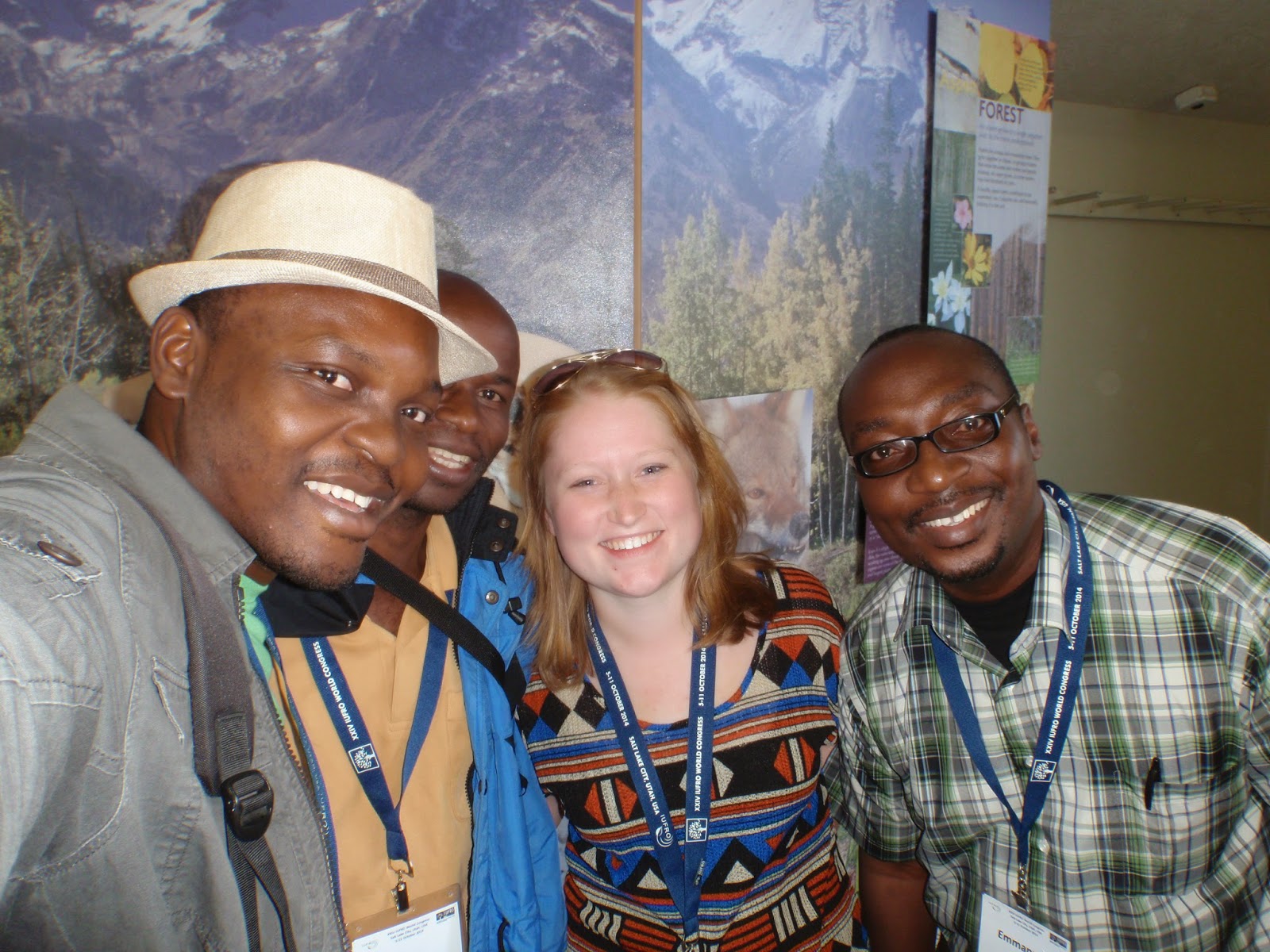
Men from Ghana and Kenya


SAF Lunch break in SLC

View from my plane ride to Portland

Saturday, November 22, 2014

Landslides Ahead!


This landslide overflowed onto a mainline.
It measured about 3/4 hectare or 3 acres.
Yreka Main.
Culvert overflow.
Teeta 500.
Okay so one should know a little bit about what causes landslides. WATER! Well look at that when it rains a whole bunch the soil can become saturated and liquefies and gravity moves it downward!  It is particularly common in areas with steeper slopes, thicker soils, and exposed soil.  While logging can exacerbate landslide frequency proper forest management and road building can help lessen the impacts.   Over the last 100 years logging practices have changed a whole lot.  Heck in the last 20 years they have changed drastically!  So when the land is exposed and saturated the likelihood of landslide occurrences increases.  As land managers we can do our best to mitigate impacts.


Yreka Main road failure. 1of 3 in close proximity.
At Western we abide by a guide of TRMS or Terrain Resource Management Systems.  This guide differentiates high-risk terrain areas and requires professionals to follow a detailed list of measures to alleviate risk.  A geotechnical professional is hired to walk all of the blocks highlighted as potential risk.  They look at the rock formations, soil types, old slides, new/old road placements, steep terrain, streams, and everything in between. The goal is to minimize risk for debris flow especially that would impact fish bearing streams and habitats with high values environmentally and economically.  A combination of reports and thorough interpretations of the landscapes engineers and foresters develop plans to reduce risk and hazards for equipment operations and land movements. 
Matt & I on heli
Randy & I on heli.


Landslides happen but management is key.  For instance, this last October the North Island experienced a heavy rain event.  In fact it was 223 mm or almost 9 inches of rain in 24 hours!  As you can imagine a few landslides occurred. When 100mm of rain in 24 hours happens operations are shut down. The areas that this occurred in experienced enough slides that delayed logging and safe access to many parts of Jeune Landing. 

My place at the bottom of the slides to survey.
Really muddy!


The following week after the rainfall shutdown was lifted I accompanied the area engineer; Chris, forester reporting landslides; Matt, and operations foreman; Randy in an Astar Helicopter to check things out.  Our purpose was to record and summarize the events and damages obstructing equipment and block access.  For two hours we flew taking pictures and points of slide and road damage.  The more we knew the more efficiently we could delegate clean up tasks to the crews.  We recorded well over 50 incidents that either required clean up attention or was greater than ¼ hectare to be reported to the ministry.
The slide went all the way to the ocean!
Yreka Main.

Matt the modern day forester. Heli + Ipad. nbd
Jeune Landing.

Rock truck and hoe before much work was done.
Teeta 500.
Later on I was on site for one such clean up.  A road fill failed a corned on Teeta 500.  The road was likely originally built in the 1930s.  It is used as a mainline to connect the East to the West coasts of the island.  Hauling was occurring prior to the storm and was not safe to afterwards.  An outside engineer used a design to plan out a new fill to best suit the road.  The fill was situated on an 80% slope and required significant rocks to replace and hold up. We did not know how far we’d have to dig to find a bench to lay a new road or if we’d be luck and find bedrock.  The new fill was built up on huge pieces of rock blast out of a nearby bluff. Many truck loads of rock and fill was removed to expose the bench and set the proper road prism.  The project took almost 4 days to complete.  It closed the mainline for at least a week. There was a rock truck, excavator, and rock drill present to assist in the clean up project. 

Survey equipment and Rock drill preping to blast!
Teeta 500.
In addition to assisting with the road repair, I recorded the significant landslides to present to the ministry.  It became my job to measure the areas using pictures and Google Earth.  I had to identify the cause and effect of each incident. The tracking of these occasions are documented for further analysis for a more complete understanding of the geology and landscape reactions to landslides and debris flows.  They are associated with particular storms and can prove how severe the storm was and where it was focused.   


Improvisation at its finest!
The rock drill's boom was bent and the hoe's bucket straightened it out.

Giving the heated metal leverage.
Good thing a welder was around! Ha.